Luxembourg & the Belgian Ardennes
Itinerary: Dinant – Luxembourg – Echternach – Müllerthal – Vianden – Clervaux – La Roche en Ardenne – Durbuy – Theux
Via Dinant to Luxembourg
It’s a Sunday morning when we drive to the city of Dinant, passing Antwerp, Brussels and Namur along the way. Dinant is a not too big city in the southeast of Belgium, beautifully situated on the river Maas. Behind the old facades on the quay, a impressive high rock rises, on which an old citadel is located. In addition, Dinant is known as the birthplace of Adolphe Sax, the creator of the saxophone – a fact that does not go unnoticed when you arrive at the Pont Charles de Gaulle, which is flanked by large saxophones in the colors of various countries. Dinant is a welcome stopover on the way to Luxembourg and a great place for lunch.
From my hometown Leiden it’s a four hour drive to Luxembourg (or Lëtzebuerg, as the country is officially called). It is not the smallest country in Europe, but it is small: just under 2,600 square kilometers. The country has about 600,000 inhabitants, of which 114,000 live in the capital, which, to make it easy, is also called Luxembourg. Unique to the country is its form of government: Luxembourg is the only grand duchy in the world, a constitutional monarchy with a grand duke as head of state.
In the course of history, today’s Luxembourg has been overrun by more powerful states. It was part of the Roman Empire and the Habsburg Empire, for a while it was one of the United Provinces of the Netherlands, then French, Austrian, again French, and again Dutch, part of Prussia and occupied by Nazi Germany. Luxembourg only became an independent country after the Second World War.
Luxembourg has become rich because of the steel industry, but today the banking sector is the main source of income. The country is very internationally oriented: 150 different nationalities work in Luxembourg and half of the inhabitants were not born in Luxembourg. Every day 120,000 people travel from Belgium, France and Germany to the Grand Duchy to work. That’s more than the number of people living there! As a result French, German and Luxembourgish are used interchangeably throughout the country.
The official flag of Luxembourg is red-white-blue, just like the Dutch, but with a lighter shade of blue. In addition, you can see the unofficial flag in many places: blue and white striped with a red lion. I think it might be useful if the Luxembourgers adopted the latter as the official flag, to avoid confusion with the Dutch flag.
Luxembourg City
Early afternoon we arrive in Luxembourg, the city that is. We visit the Museum of Modern Art (MUDAM), which is located in a beautiful modern building, but unfortunately what is inside the building is less interesting (to us, at least). The museum is located in the Kirchberg district, on the north side of the Paffenthal, through which the river Alzette flows. The district has modern high-rise buildings on wide boulevards, which lead to the European institutions located here, including the European Central Bank. Especially eyecatching is the beautiful white building of the Luxembourg Philharmonic, with its 823 slender white columns.
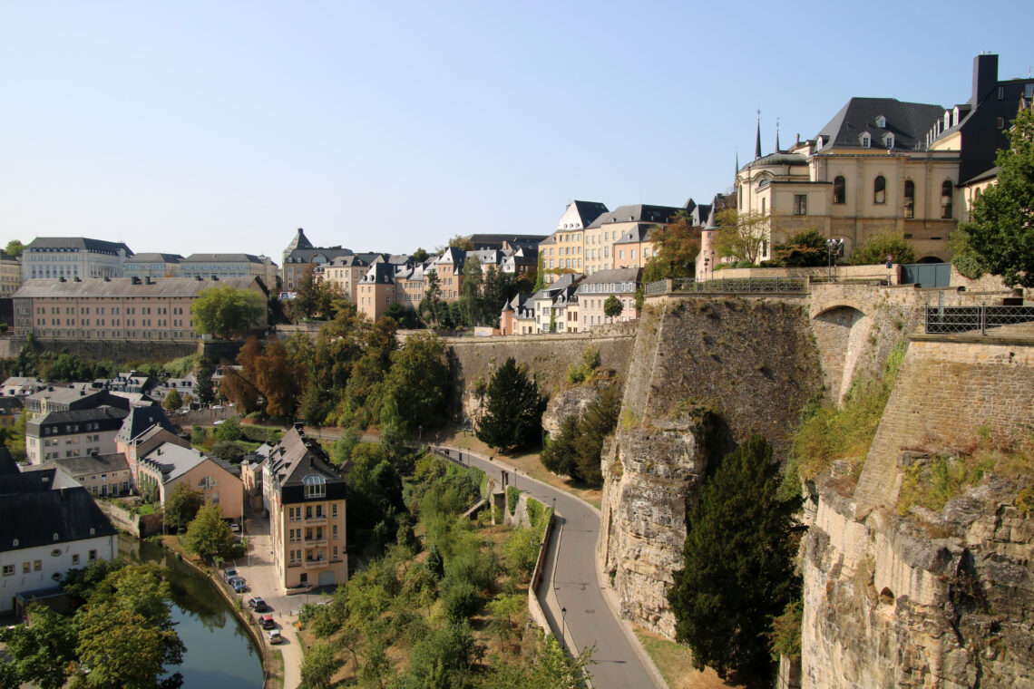
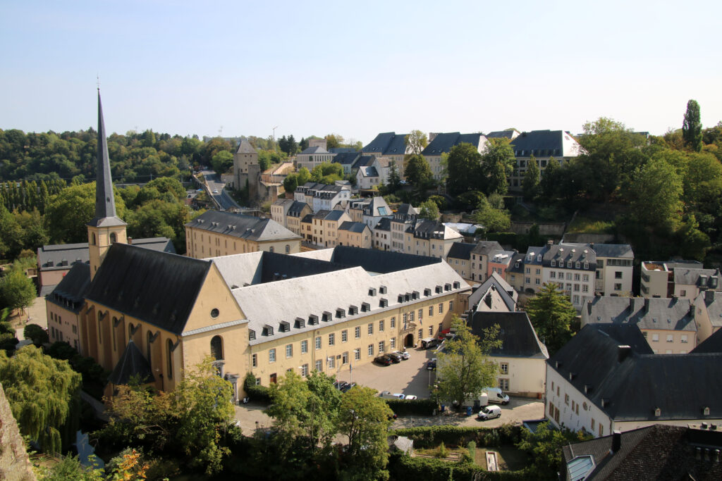
Luxembourg City was built on the spot where two (small) rivers, the Pétrusse and the Alzette, meet. The two rivers flow at the foot of a cliff and on top of that cliff a fortress called Lucilinburhuc was built in the year 963. That first fortress is no longer there, but the fortifications that were built in subsequent years still are. The entire old part of Luxembourg City is on the UNESCO World Heritage List.
The next day the weather is beautiful and sunny and no less than thirty degrees. Not bad for September! We start our city walk at Place de la Constitution. In the middle of this square stands Gëlle Fra, the golden lady, on a twelve meter high obelisk. From the edge of the square you have a great view over the green Parc de la Pétrusse and the Pont Adolphe, which spans the valley of the Pétrusse.
In the old part of Luxembourg City you find small streets with buildings from the seventeenth, eighteenth and nineteenth centuries, and several squares, such as the Place d’Armes, with trees and terraces. This square was already there in 1671! A little further on is Place Guillaume II, named after the Dutch king Willem II, whose statue stands in the middle of the square. On the south side of the large, somewhat bleak square, is the Luxembourg City Town Hall, built in 1830.
A narrow street leads from the square to the Palais Grand-Ducal, the Royal Palace. Like the Royal Palace on Dam Square in Amsterdam, this palace was originally the city hall of Luxembourg City. It was built in 1573 and became a royal palace in 1890. Next to the palace is the relatively small building of the Chamber of Representatives, the ‘Lower House’ of the parliament of Luxembourg.
Via the Marché au Poisons (Fishmarket) we walk towards the Bock-cliff. From here you have an amazing view of the old town, the city walls and the Grund district below. Via the Chemin de Corniche you can walk along the top of the old city wall and see this part of the historic center of Luxembourg City from all angles. That’s why the Chemin de Corniche is nicknamed ‘the most beautiful balcony in the world’.
The river Pétrusse, which separates the old town on top of the cliff from the lower district of Grund, is no more than a fifty centimeters wide stream. The green valley down which the Pétrusse flows, on the other hand, is a wonderful green oasis in the middle of the city and a very nice (and on a hot day cool) place for walking or relaxing.
Echternach and Müllerthal
On Tuesday morning we drive in half an hour from Luxembourg City to Echternach, close to the border with Germany. (Luxembourg is so small that you can actually drive to any place in the country within half an hour…) Echternach is a small village with a picturesque historic center, which has a German feel to it. The heart of Echternach is formed by Place du Marché (which admittedly doesn’t sound German), an attractive square with cafes and restaurants. Of all the old buildings here, the Dënzelt building is particularly striking, a beautiful building from the fourteenth century (but since then regularly renovated).
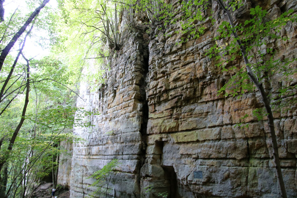
Echternach is located on the edge of the Müllerthal, a vast nature reserve where you can follow many trails. The Dutch nicknamed this area ‘Little Switzerland’, which is perhaps a bit exaggerated: you will not find mountains here, but you will find hills, rocks, caves, valleys and forests. We walk route E1 from Echternach to Berdorf. After a tough start, where the route climbs quite steeply, what follows is a beautiful walk in the forest (where it is fortunately slightly cooler than thirty degrees in the sun), along meters high limestone rocks and down the truly beautiful Wolf Gap. A must for anyone visiting Luxembourg!
Vianden and Clervaux
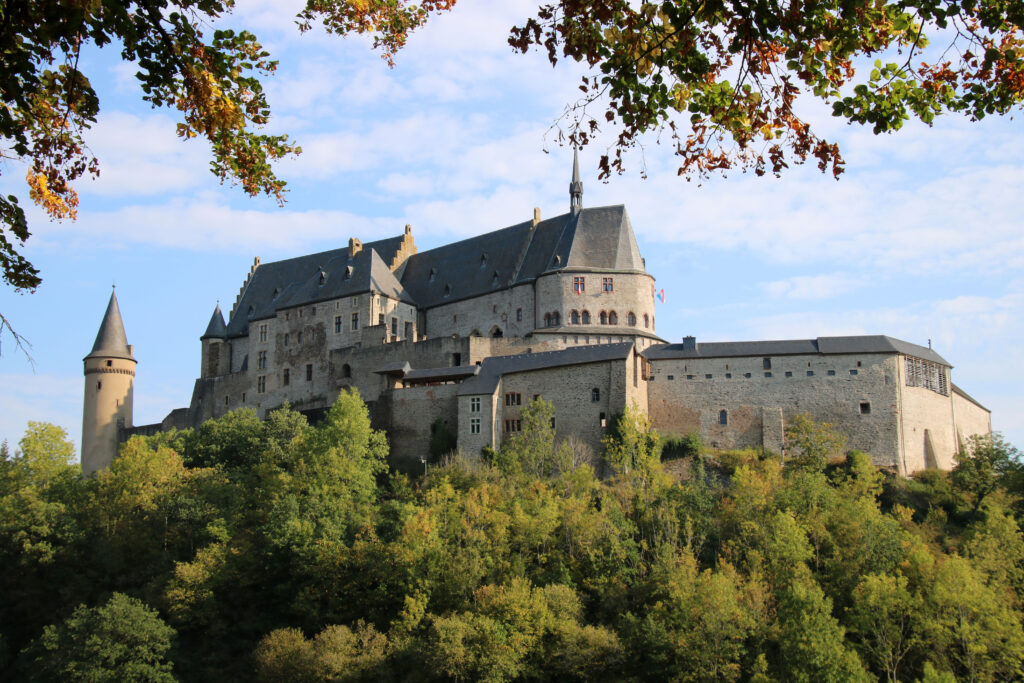
The next day we drive in half an hour to Vianden, a small village with a large medieval castle, which towers impressively on top of a hill above the village. You see the castle, which was built between the eleventh and fifteenth century, way before you can see the village.
After a coffee stop and a walk in Vianden we drive through a rolling landscape to Clervaux. This is also a small village with a castle you cannot miss. But unlike the castle in Vianden, the white castle of Clervaux stands in the middle of the village. Dating back to the twelfth century, it was badly damaged in the Second World War, but has since been restored to its original state.
The castle houses The Family of Man, the largest permanent photo exhibition in the world. The collection was put together in 1955 for the Museum of Modern Art in New York, and since 1994 the photos can be viewed in the castle of Clervaux. It’s a beautiful exhibition, with photos of people from all over the world (in the 1950s), all in black and white, sorted by themes such as love, work and war. Well worth it!
Belgian Ardennes
On Thursday morning we cross the border between Luxembourg and Belgium and enter the eastern part of Wallonia. This is the wooded hilly landscape of the Ardennes. After an hour’s drive, we stop in La Roche en Ardenne, perhaps the most popular town in the Belgian Ardennes, located on the river Ourthe.
We then drive through the hilly landscape of the Ardennes region to Durbuy. Like La Roche en Ardenne, Durbuy is located on the river Ourthe. It is a beautiful, but very touristy town, with a picturesque center dating back to the Middle Ages. The houses along the narrow cobbled streets almost all date from the seventeenth and eighteenth centuries. The seventeenth-century Castle of Durbuy is located on the banks of the Ourthe. You can also take a look at the Roche du Valize, a high, 300 million year old rock with an odd shape, which is the result of the limestone layers slowly being pushed up.
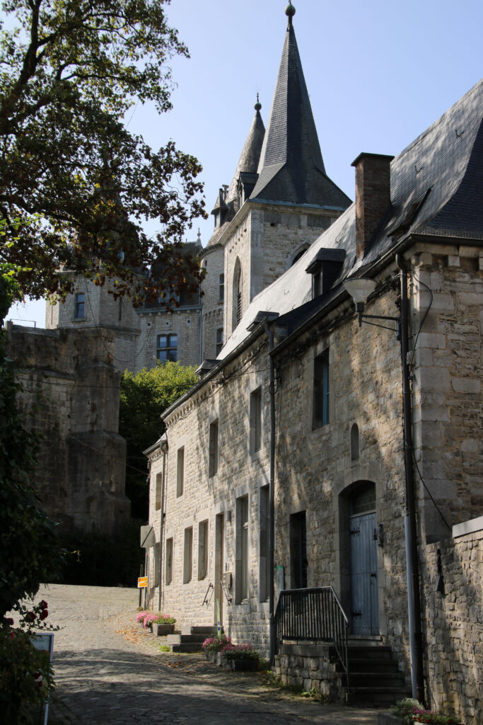
We spend the night in the otherwise not very remarkable village of Theux, which serves as a base for the last two days in the Ardennes. On Friday we take a walk along the river Ninglinspo, near the village of Aywaille. A lovely walk of six kilometers in the forest, along the river and past small waterfalls. Occasionally you walk across a wooden bridge over the water and regularly you walk up and down rocks, but the walk is doable. The last part you walk on a wide forest path, past a lookout point and finally back to the starting point.
Another walk follows on Saturday, this time along the river Hoëgne. This beautiful walk is similar to the one along the Ninglinspo and also leads through the forest, along the water. After a late lunch we drive back to Leiden in about three hours. It was a nice week away in surprising Luxembourg and the green surroundings of the Ardennes.


